

Description
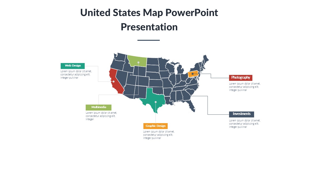
The United States Map PowerPoint Presentation slide template is a meticulously designed PPT template tailored to meet the diverse needs of educators, business professionals, and policy advocates. This comprehensive presentation template includes a variety of slides, each featuring high-quality, customizable maps of the United States. Each map is designed to assist in the visualization of geographical, demographic, and economic data across different states and regions within the U.S.
Ideal for a broad range of applications, the United States Map PowerPoint Presentation PPT template serves as an essential resource for teachers elucidating the geographic diversity of the United States, business professionals analyzing regional market data, or political advocates outlining campaign strategies or policy impacts by state. The slide templates are crafted to support clear, impactful presentations, ensuring that every audience gains a deeper understanding of the content being presented.
This PPT slide template is not only a visual aid but also a functional toolkit designed to enhance the effectiveness of your presentations. With easy-to-edit features, presenters can quickly adapt each slide to suit their specific needs, whether it’s changing colors, resizing map areas, or adding text annotations. The versatility of the United States Map PowerPoint Presentation PPT template makes it an invaluable asset for anyone needing to present state-specific or nationwide data in a clear and engaging manner.
With its professional design and user-friendly features, this presentation template stands out as a superior choice for anyone requiring a reliable and effective way to present data related to the United States. It’s crafted to ensure that whether you’re teaching a class, presenting at a conference, or advocating for a cause, your information is delivered in a visually appealing and precise format.
Features:
– Fully editable maps: Customize colors, sizes, and text to fit your specific presentation needs.
– High-resolution graphics: Ensures that all maps and accompanying visuals are clear and impactful.
– Wide compatibility: Works seamlessly with PowerPoint, ensuring easy integration into your existing presentations.
– Multiple slide layouts: Includes a variety of map styles and data display options to choose from.
– Immediate download: Access your PPT template right after purchase to start customizing your presentation.
Use Cases:
– Perfect for educational settings: Teachers can use the maps to explain U.S. geography, history, or social studies.
– Essential for business presentations: Ideal for displaying market research, sales territories, or logistic networks across the U.S.
– Valuable for political campaigns: Use it to strategize electoral approaches or to present policy impacts by region.
– Useful for non-profits: Aid in the presentation of data on regional disparities, resource allocation, or awareness campaigns.
– Applicable in tourism industry presentations: Showcase travel routes, tourist attractions, and regional highlights of the United States.
There are no reviews yet.