

Description
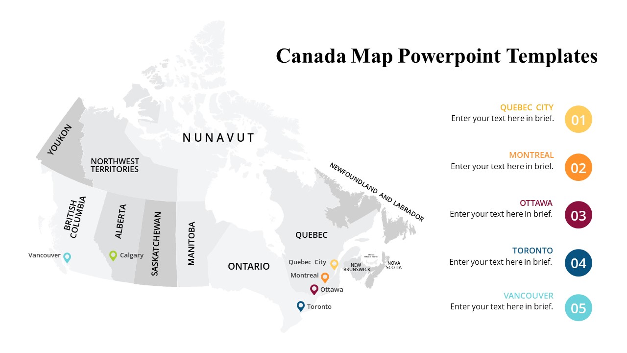
The Canada Map PowerPoint Templates are essential tools for anyone looking to create visually stunning presentations that involve geographical data related to Canada. Whether you are working on a business project, educational seminar, or research report, these templates will provide you with all the necessary components to effectively showcase information about Canada’s regions, provinces, and cities.
Featuring a high-quality map of Canada with detailed outlines of each province and territory, these PowerPoint templates are fully editable, allowing you to customize the design to suit your specific needs. The templates include various slides that can be easily tailored to display different types of information, such as demographics, economic data, travel statistics, and more. With the option to change colors, fonts, and sizes, you can truly make these templates your own and create a presentation that is both engaging and informative.
The Canada Map PowerPoint Templates come with a user-friendly interface that makes it easy for anyone, regardless of their level of expertise in PowerPoint, to navigate and manipulate the slides. Whether you are a beginner or an experienced user, you will find these templates to be intuitive and convenient to work with. Additionally, the templates are compatible with both Windows and Mac systems, ensuring that you can access and use them on any device.
In conclusion, the Canada Map PowerPoint Templates are a valuable resource for professionals, educators, researchers, and students who need to present data related to Canada in a visually appealing manner. With their fully editable features, user-friendly interface, and compatibility with various systems, these templates are sure to enhance your presentations and help you effectively communicate information about Canada’s geography and demographics.

There are no reviews yet.