

Description
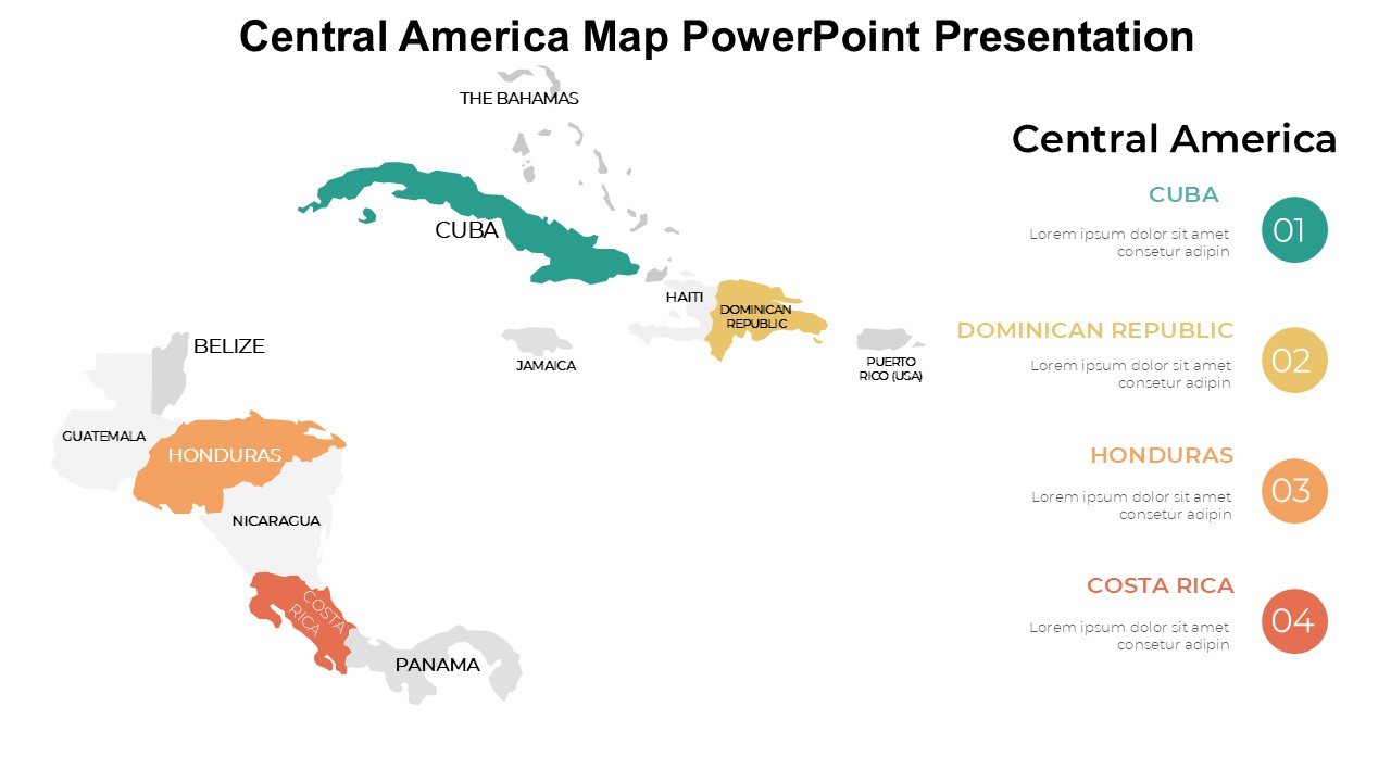
The Central America Map PowerPoint Presentation PPT template is a meticulously designed slide template for educators, professionals, and advocates who require a detailed and interactive map of Central America. This presentation template is perfect for those looking to deliver in-depth geographical, cultural, or socio-economic presentations about the region. Whether you are a teacher explaining the diverse ecosystems of Central America, a business professional discussing market expansions, or an advocate outlining regional issues, this slide template will serve as an invaluable resource.
This PPT template includes a comprehensive set of slides, each featuring high-quality maps of Central America and its countries, including Guatemala, Belize, Honduras, El Salvador, Nicaragua, Costa Rica, and Panama. The slides are designed not only to show geographical borders but also to allow the integration of data related to various demographic and economic indicators. The flexibility of the design ensures that it can be adapted to suit different presentation goals, from educational lectures to business strategy sessions and advocacy meetings.
The Central America Map PowerPoint Presentation slide template is crafted to enhance audience understanding and engagement through clear, visually appealing maps enhanced with customizable icons and markers. Users can easily add specific details such as capital cities, major towns, significant landmarks, and routes, making it a highly effective tool for detailed regional studies.
This PowerPoint slide template is user-friendly, allowing presenters to seamlessly modify colors, text, and layout to fit their specific needs without compromising on quality or professional appearance. It supports a narrative that is both informative and engaging, making it easier for the presenter to convey complex information in a digestible format.
Features:
– Fully editable templates: Customize every element of the slides with ease.
– High-resolution maps: Ensure clear and impactful presentations.
– Versatile design: Suitable for a wide range of presentation needs.
– Easy to use: User-friendly interface that requires no prior design experience.
– Compatibility with PowerPoint: Ensures a smooth presentation experience.
Use Cases:
– Ideal for educators teaching Central American geography or history.
– Essential for business professionals discussing regional investments or market analysis.
– Useful for NGOs presenting on regional issues such as conservation, healthcare, or human rights.
– Beneficial for government agencies mapping out development projects or emergency responses.
– Perfect for travelers and travel agencies creating detailed itineraries or promotional materials about Central America.
There are no reviews yet.